
#lidar


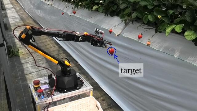
Ein autonomer #Roboter der Osaka Metropolitan University navigiert mit #Lidar präzise durch #Hochbeete und kann sogar empfindliche Früchte wie #Erdbeeren ernten.
Grundlage ist eine Kombination aus virtueller Simulation und realer Testumgebung. Das System spart Zeit und Kosten und eröffnet neue Möglichkeiten für automatisierte #Landwirtschaft.
Voraussetzung sind aber kontrollierte Umgebungen, Fahrbahnen und etwa Hochbeete. 

Hackaday: A Pi-Based LiDAR Scanner . “Early LIDAR systems were cumbersome and expensive but as the march of time continues on, these systems have become much more accessible to the average person. So much so that you can quickly attach one to a Raspberry Pi and perform LiDAR imaging for a very reasonable cost.”
https://rbfirehose.com/2025/04/21/hackaday-a-pi-based-lidar-scanner/

NOLA.com: Tulane keeps finding lost Maya cities, thanks to technology that's changing archeology

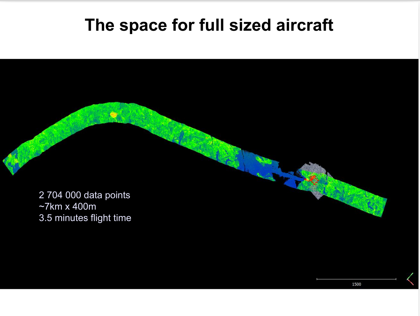
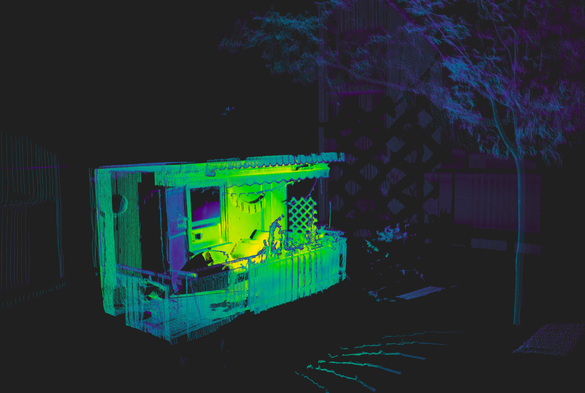
A decade ago I presented this pair of slides to an all-staff seminar at the Australian Antarctic Division. First shows a lidar pass as a reasonable scale for piloted aircraft. Second is a dense point cloud of a ship in sea ice showing a reasonable scale for RPAS/drone operations.
This is still true. At the time no small RPA existed that could operate in those conditions. In 2021/22 I was flying one in the Arctic, and it turns out slide 2 was very optimistic!


 Ah, the Raspberry Pi #Lidar Scanner! Because clearly the world needs yet another DIY project that combines everyone's favorite $35 computer with the one trillionth version of a 'better' Github integration.
 Now, armed with this unstoppable duo, you too can scan your cat in 3D while achieving absolutely nothing of practical value!

https://github.com/PiLiDAR/PiLiDAR #RaspberryPi #DIYProjects #GithubIntegration #3DScanning #CatScanner #HackerNews #ngated


Someone made a LiDAR scanner with a Raspberry Pi, and it looks awesome
https://squeet.me/display/962c3e10-443c7fbe-8afc75d824ba8b80


Someone made a LiDAR scanner with a Raspberry Pi, and it looks awesome
“If you’ve never heard of LiDAR before, it stands for “Light Detection and Ranging.” It can map out an area by firing lasers at it and recording how long it takes for the reflected light to return. It’s a handy way of creating a 3D model of a physic ...continues
See https://gadgeteer.co.za/someone-made-a-lidar-scanner-with-a-raspberry-pi-and-it-looks-awesome/


Someone made a LiDAR scanner with a Raspberry Pi, and it looks awesome.
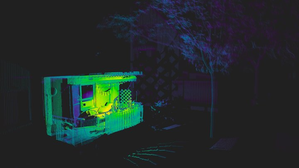


A Pi-Based LiDAR Scanner - Although there are plenty of methods for effectively imaging a 3D space, LiDAR is ... - https://hackaday.com/2025/04/18/a-pi-based-lidar-scanner/ #2dvisualization #raspberrypi #vertexcolor #laserhacks #3dscanning #ldrobot #camera #lidar

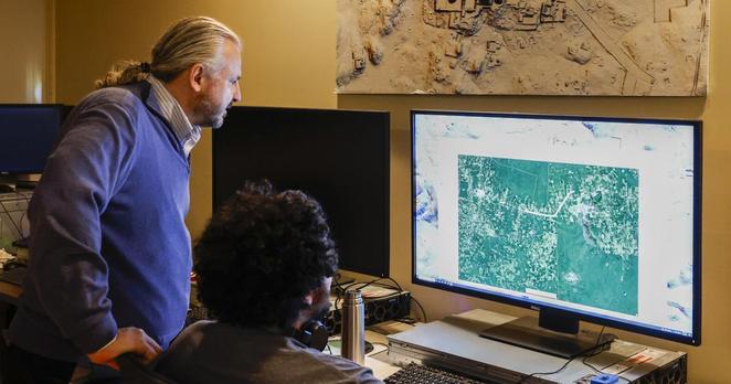
Excited to share that I'll be presenting at #EGU25 on April 30, 09:55 CEST in Room L2! My talk, "Low-Cost lidar as an Easy-to-Use REST API: Permanently Installed Systems for Cryospheric Research and Beyond," will delve into our integrated hardware-software solution for deploying low-cost #lidar systems in challenging environments. Discover how we're simplifying data collection and analysis for cryospheric studies. More details here: https://meetingorganizer.copernicus.org/EGU25/EGU25-14949.html

SciTech Chronicles. . . . . . . . .April 17th, 2025
#Donaldjohanson #SwRI #"12.5 light minutes away" #"observation sequence" #raindrops #"plug flow" #10% #"electrically conductive polymer" #"Neurospora crassa" #"Sporosarcina pasteurii" #mineralized #microarchitecture #Hyperadaptor #nickel-based #temperature-insensitive #"sudden or extreme temperature changes" #"high-bed cultivation" #Lidar #disease #pruning


 Greg Cocks
 RiverREM - Generating River Relative Elevation Model (REM) Visualisations
--
https://github.com/OpenTopography/RiverREM <-- shared GitHub repository
--
https://opentopography.github.io/RiverREM/ <-- shared documentation
--
https://opentopography.org/blog/new-package-automates-river-relative-elevation-model-rem-generation <-- shared Open Topography blog post about RiverREM
--
H/T Heidi Luchsinger / Open Topography
[this post should not be considered as an endorsement of this product aka caveat emptor]
#GIS #spatial #mapping #remotesensing #earthobservation #Python #LiDAR #RiverREM #visualisation #hydrology #water #river #rivervalley #floodplain #terraces #GitHub #opensource #opendata #DEM #REM #model #modeling #RiverRelativeModel #documentation #tutorial #learning #tool #elevation #raster #sinuosity #drainage


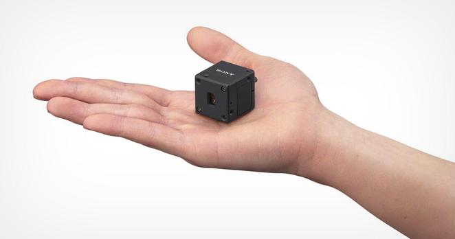
Sony Unveils the World’s Smallest and Lightest LiDAR Depth Sensor https://petapixel.com/2025/04/15/sony-unveils-the-worlds-smallest-and-lightest-lidar-depth-sensor/ #singlephotondetector #lidardepthsensor #machinevision #depthsensor #Technology #autonomous #Equipment #lidar #News #Sony #SPAD
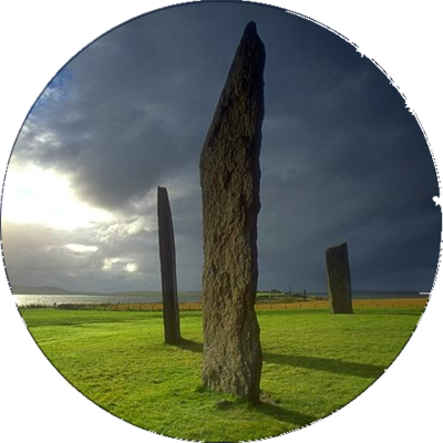
stone circles : cost-effective photogrammetry techniques for surveying, recording, documenting [pdf 25pp] #StoneCircle #photogrammetry #KiriEngine #lidar https://arrow.tudublin.ie/cgi/viewcontent.cgi?article=1230&context=level3


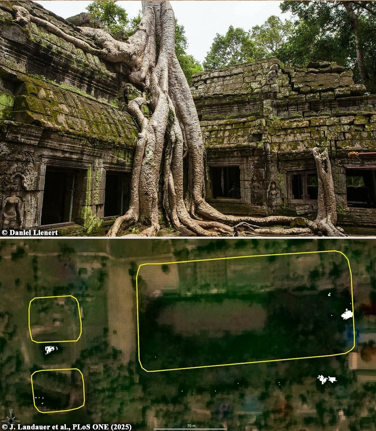
AI aids large-scale mapping of Angkorian reservoirs beyond Greater Angkor
A group of international researchers has harnessed the strength of artificial intelligence to reveal previously unknown reservoirs from the Angkorian period in Cambodia...
More information: https://archaeologymag.com/2025/04/ai-aids-mapping-of-angkorian-reservoirs/
Follow @archaeology
Sony Electronics Announces the World's Smallest and Lightest[1] Miniature Precision LiDAR Depth Sensor
![Sony Electronics Announces the World's Smallest and Lightest[1] Miniature Precision LiDAR Depth Sensor
https://www.prnewswire.com/news-releases/sony-electronics-announces-the-worlds-smallest-and-lightest1-miniature-precision-lidar-depth-sensor-302426709.html
#LiDAR #GeoSpatial #Sony](https://cdn.fosstodon.org/media_attachments/files/114/330/412/882/324/167/original/601a2546f824d6ce.jpg)

Fairly disappointed, but not altogether surprised, that the new Non-forest Tree mapping from Forest Research is not really useful for mapping trees on #OpenStreetMap. Mostly it only has 1 m resolution Lidar, so the map shows canopy above 3 metres in height. Undoubtedly useful for other purposes, such as shade calculations.
https://www.forestresearch.gov.uk/tools-and-resources/fthr/trees-outside-woodland-map/
#TreeMapping #Lidar #EnvironmentAgeny # ForestResearch #OpenData